Robot Dogs Now Using LiDAR for Search and Rescue
Automated Search and Rescue
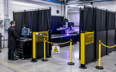
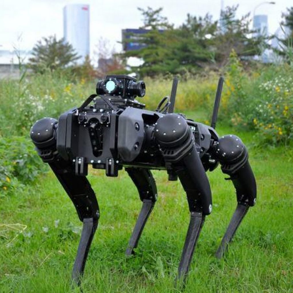
The United States Air Force is experimenting with using laser sensors deployed on robot dogs to survey collapsed and damaged buildings. Their goal is to use LiDAR sensing [4] to provide structural details before a human enters a collapsing or damaged building during search and rescue operations. This program was created as part of the ongoing restoration happening at Tyndall Air Force Base in Florida following the 2018 Hurricane Michael which damaged both the facilities and planes stored there. The demonstration program uses LiDAR devices mounted on the Boston Dynamics Spot dog-shaped robot. [1]
LiDAR for Remote Sensing
LiDAR stands for Light Detection And Ranging [4] and is a remote sensing method that dates to the 1960s. It was first used by engineers and surveyors to produce highly detailed topographical maps of roads, streams, and other important landscape features. LiDAR measurement devices use light energy emitted by a laser to scan the ground and measure variable distances based on the returned reflection. The measurement uses the speed of light and captures the two-way travel time of a beam of light to the scanner to build a 3D point cloud of the scanned area. The intensity of the returned signal can be used to distinguish the type of surface the return came from. This typically gives enough detail to identify real-life objects in the LiDAR data; the results can produce high-resolution maps and 3D models of natural and man-made objects.
Putting LiDAR on robots and other drones gives the military a way to map the interior of a building using a machine without exposing humans to danger. The collected LiDAR data gives an operator using a tablet outside the building a view of the inside or allows remote decision making to be performed offsite. The human operators, local or remote, can see what the robot sees in real-time and can direct the robot as needed to gather more information. These operations are similar to how LiDAR sensors are used on many self-driving (or collision avoidance mode) cars to autonomously detect real-time changes around the moving vehicle and then signal navigation or steering changes needed to keep the car and its occupants safe.
In the case of structural and building scans, this scanning also provides a virtual model useful as a tool for regular maintenance and repair, and it provides a record of a prior state should disaster strike. These techniques could also enable better failure investigations after the fact for future damage. For example, comparing LiDAR scans of downed or wrecked craft to those before launch, and to surviving aircraft that made it back from a sortie, the Air Force could understand how to make more durable craft.
Another potential use case is using a LiDAR scan of a damaged roadway or runway surface to automate the calculation of the amount of material needed for a repair. This may seem like a mundane task, but in an automated future this type of automatic detection and repair could be vital to the safe operation of planes or other vehicles.
Robot Dogs on Patrol
The search, survey and rescue program is a continuation of the Air Force’s research into using robotic guard dogs to also patrol the perimeter of Tyndall AFB in Florida. The Air Force decided to use the rebuilding of Tyndall AFB following the extensive damage from Hurricane Michael as a technology showcase for many advance and interconnected technologies. The initial robotic patrol program uses Ghost Robotics Quadrupedal Unmanned Ground Vehicles, or Q-UGVs, Vision 60 model to patrol the base. [2]
The patrol robots use LiDAR for their own navigation and mobility and combine pressure inference from their leg motors to walk across indeterminate terrain where it is not possible to see a clear path. This allows the robotic dog to use the Tyndall base damage and ongoing reconstruction as a real-world test of their ability to traverse various changing landscapes in remote areas of the base.
The robot sensor platform can be enhanced to include high-definition video streaming, thermal imaging and even infrared if needed. All of these sensor streams can be sent over a data connection to a tablet used by a human operator to “see” what the dog is seeing. The patrol robots are semi-autonomous but can also accept commands from their operator, including the ability for the operator to issue remote commands via the dog to communicate to people it encounters.
Military Technologies Transitioning to Commercial Uses
LiDAR is just one of several sensing technologies being used for military applications that are transitioning to the commercial market. A MilSource blog summarized the following additional military use cases that are also rapidly being consumed in the commercial market [3]:
Hyperspacial Sensors
Using reflections from hundreds of bands in the infrared electromagnetic spectrum. Hyperspacial sensor use the combined reflection of various IR wavelengths to determine the material a target is made of. This analysis allows the results to be compared against the “fingerprint” of known objects. Applications include detecting roadside bombs and identifying illegal drugs among other plants.
Wide Area Surveillance
Combining hundreds of powerful imaging sensors arrayed to take simultaneous image of large geographic areas. This large amount of collected data becomes available for operators to search and zoom down into any particular object or movement captured over a large time period. Applications include isolating traffic movements or monitoring military activities in an active war zone.
Multi-spectral Targeting Systems
Using infrared sensors, a daylight TV camera (color or monochrome) and an image intensified TV camera that are combined together enabling individual feeds to be highlighted in one larger image. This enables long-range surveillance, high-altitude tracking and target acquisition via detailed images captured large distances away from the monitored area.
LiDAR itself is evolving from basic terrain scanning for high-resolution maps into more sophisticated applications such as enabling self-driving vehicles and semi-autonomous robot patrol dogs. It is also being incorporated into sophisticated drone technology combining multiple sensors together to generated enhanced views of the highway, the construction site or the battlefield.
How Laser Safety Certification can help
At Laser Safety Certification, we have laser safety courses and Laser Safety Officer certification programs to make sure your team are correctly using lasers and your customers are protected. We can help with your laser safety training needs if you are using lasers in manufacturing or production applications, or if you are using them in medical or healthcare fields and have concerns about your patient safety.
We have laser safety certification courses for Industrial, Cosmetic or Medical/Healthcare and Veterinary laser users. We also have Laser Safety Officer (LSO) certification courses to help organize your company laser safety program. Our certification courses are based on the current OSHA guidelines and Technical Manual sections that apply to laser hazards and safety program. We also have laser safety kits and training bundles to help your LSO administer your own laser safety program to protect your team as well as your customers.
Click here to enroll your company to get started today. Or check out our FAQ section for common answers about our courses, certification options and kit offerings, and get started by enrolling your company today. You can always email us at info@lasersafetycertification.com if you want more information about how we can help your business use lasers safely while protecting your employees and customers.
References
[1] Popular Science, LiDAR on robot dogs: https://www.popsci.com/military/air-force-laser-sensors-on-robot-dogs/
[2] Popular Science, Robotic guard dogs: https://www.popsci.com/story/technology/robotic-security-dogs-tyndall-air-force-base/
[3] MilSource miltech blog, Military drone technologies: https://www.militaryethernet.com/4-military-sensor-technologies-drones-transporting-commercial-market/
[4] LiDAR vs LIDAR etymology: https://geozoneblog.wordpress.com/2014/04/09/lidar-case-matters/
Boston Dynamics Spot: https://www.bostondynamics.com/products/spot
Ghost Robotics Q-UGV: https://www.ghostrobotics.io/vision-60
Image Credit, Ghost Robotics: https://www.ghostrobotics.io/vision-60